
Hiking Around Las Vegas, Gold Butte National Monument

 Fisherman Cove Road approaching trailhead (view SW) |
Overview Peak 962, one of the highpoints on Black Ridge, makes for a nice hike and a good way to experience grand views with relatively little effort. This hike can be done as a 4-mile in-and-out hike or as a 5-mile loop, and it is accessible using 2WD vehicles. With few landmarks, this is a good route to practice GPS waypoint-following skills. The hike starts by following washes on a gentle bajada to an historic mining area, then ascends a fairly steep and strenuous gully (no cliffs) to the crest of Black Ridge. The saddle on the crest has grand views and is a good place to end the hike. Continuing, the route follows the moderately strenuous ridgeline to the summit (elevation 962 meters = 3,156 ft) where hikers are rewarded with great 360-degree views that stretch from California to Utah. Following the ridge farther west to a deep saddle, the route descends steeply south until returning across the rolling bajada to the trailhead. Link to map. |
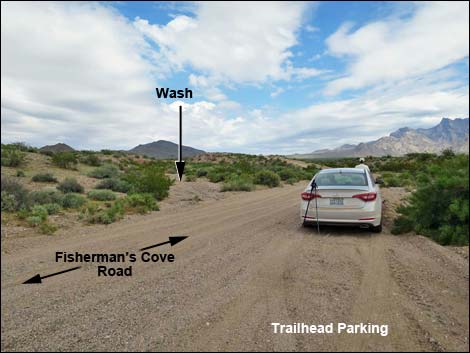 Trailhead parking in wash (view NE) |
Watch Out Other than the standard warnings about hiking in the desert, ... this area is fairly safe, but watch for the mine shaft (don't fall in!), and parts of the route are steep and loose enough that hiking poles are recommended on this off-trail hike. This is a wild and remote area without services of any kind (no restrooms, no water, no gas, no food). Bring what you need to survive. Be prepared and be self-reliant. Law enforcement occasionally patrols the area. Someone will find you eventually if you stay on a main road, but be prepared to survive alone for a day or two. Cell phones work on parts of this hike. While hiking, please respect the land and the other people out there, and try to Leave No Trace of your passage. Also, this is a very remote hike, so be sure to bring the 10 Essentials. |
 Starting up the wash (view NNE) |
Getting to the Trailhead Peak 962 is located on Black Ridge out in Gold Butte National Monument, about 1.5 hours northeast of Las Vegas in a wild, remote, and scenic area. From Las Vegas, drive out towards Gold Butte National Monument. From Highway 170 at Gold Butte Road, drive south for 14.3 miles to Fisherman Cove Road. Driving out, Gold Butte Road passes the Gold Butte entrance sign at 12.1 miles; Fisherman Cove Road is about 2 miles farther. Turn right onto Fisherman Cove Road and drive southwest 2.9 miles. The road heads down the bajada, runs up over an odd highpoint on the desert flats, and then descends to cross a broad wash. If flash floods are unlikely, park in the wash; this is the trailhead. |
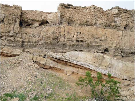 Interesting geology along the wash (view E) |
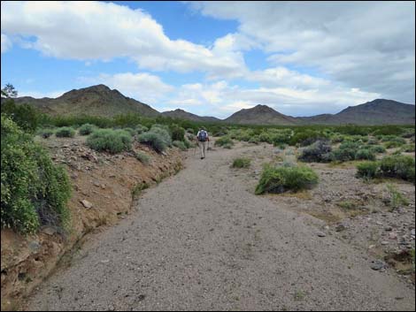
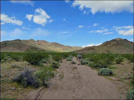
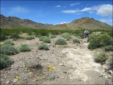
The Hike From the trailhead (Table 1, Waypoint 01), the route runs up the broad wash below low cliffs (with interesting geology) that can be seen from many places along the route. Take note of the cliffs and reflect on them during the hike to keep in mind an idea of where to go when hiking out across the featureless plain. It is also useful at this point to look ahead and locate the saddle on the ridge. This is big, broad country, and it would be easy to follow the main wash off too far to the northeast. Continuing generally north up the gentle wash, it is useful to turn out of the main wash (Wpt. 02) into a narrower side wash to the left. This wash narrows until it is better to step right out of the wash (Wpt. 03) and just walk on the desert flats heading more northwest into the canyon that separates the two major hills that now lie ahead. At about 1.07 miles out, the route drops into another major wash (Wpt. 04) that follows the base of the hills on the left. This wash fans out to blend into the desert flats below, so this is not a good wash to find from below. |
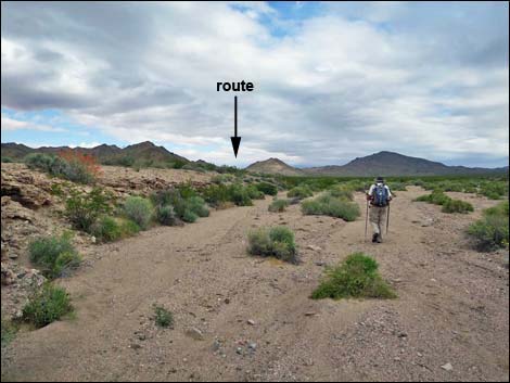 Hiker in broad, main wash (view NNE) |
Continuing up the wash, the route becomes easier to follow. At about 1.3 miles out, sharp-eyed hikers may see a stone cairn above the wash on the left. If so, detouring to the cairn and continuing southwest behind a rocky knob about 150 yards, hikers will find a 20-ft-deep mine shaft (Wpt. 20) with a white tailings pile. It must have been hard work digging this pit by hand, and it is interesting to contemplate the lives of people who toiled on this desert landscape. Returning to the wash, the route continues northwest into the narrowing canyon. At about 1.62 miles out, the wash forks (Wpt. 05) three ways. The main fork goes right, a major fork goes left, and the route goes into the middle fork. Shortly, it becomes evident that an old mine road (Wpt. 06) heads up the middle fork and onto the hillside above. Following the old road, hikers approach a tailings pile on the right, and then the road turns hard to the left (Wpt. 07). At this point, the route leaves the old road and heads straight up (northwest) the gully above to a saddle (Wpt. 08) on the crest of the ridge. |
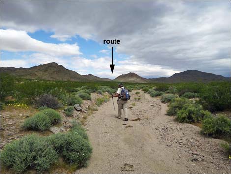 Hiker in narrower wash (view N) |
For some hikers, the saddle (Wpt. 08) is a great place to stop. The views north and south are grand, and views east aren't bad, but the ridge blocks views to the west. After taking a rest and enjoying the views, the route turns southwest and follows bighorn sheep trails up across the hillside to regain the ridgeline. On the ridgeline, the route continues southwest towards the summit. There are several false summits, but the hiking is not hard and eventually the route arrives at the true summit (Wpt. 09; 962m, 3,156 ft). This isn't the highest point on Black Ridge, but it seems good enough to me. Relax and take in the views. Looking north, the Mormon Range dominates the view, but mountain ranges far into Nevada (left) and Utah (right) can be seen. To the east, the view is dominated by the Virgin Range, which stretches east into Arizona. To the south, Tramp and Lime ridges form the central highlands of Gold Butte, but views southeast stretch into Arizona and the mouth of the Grand Canyon. To the southwest, views stretch into California. Looking west, the view is dominated by Black Ridge, but Mt. Charleston in the Spring Mountains and Hayford Peak in the Sheep Range are visible. |
 |
Departing the summit to the west, the route follows the ridge while winding among low cliffs. Hikers need do no scrambling, as vertical sections can be bypassed. Arriving on the deep saddle (Wpt. 10), the route turns south and runs down the steep hillside into the gullies and washes below. Some parts are steep with loose gravel, but the route is not dangerous. Following the canyon down, it is easier in places to hike on the desert flats above the wash. Hikers should watch for game trails that eventually cross to the east side of the wash. From there, the walking is much easier on the desert flats, which are followed down and out of the mountains (Wpt. 11). When out of the canyons, hikers can see the cliffs near the trailhead and hike across the rolling desert flats until returning to the road (Wpt. 01). |
 |
 |
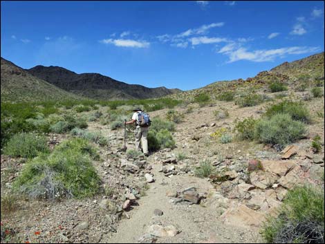 It becomes easier to leave the wash to the right (view NW) |
 Back into a broad wash in the canyon (view NW) |
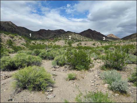 The wash forks three ways (view N) |
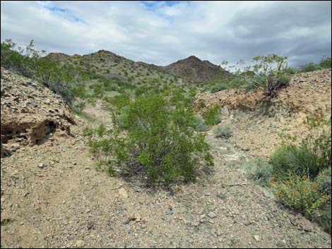 Starting up the middle of the three washes (view N) |
 A road appears from nowhere (view NW) |
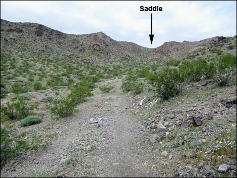 The route follows the old road (view NW) |
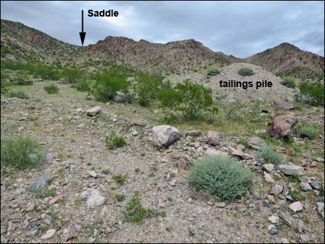 At a tailings pile, the road bends left (view NW) |
 Route follows along mine trench (view N) |
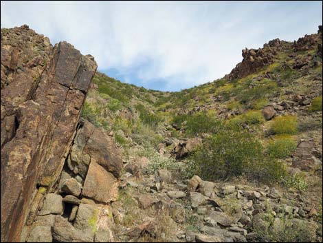 Route runs up this canyon (view NW) |
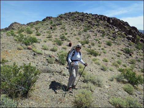 Hiker stops a few yards below the saddle (view NE) |
 From the saddle, the route follows game trail west (view SW) |
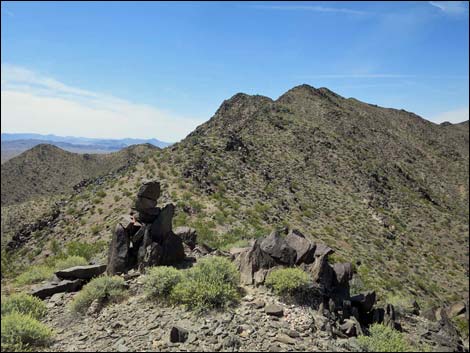 Back on the ridgeline (view SW) |
 Following the ridge (view SW) |
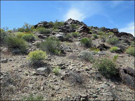 Following the ridge towards false summit (view SW) |
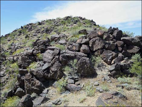 Following the ridge towards false summit (view SW) |
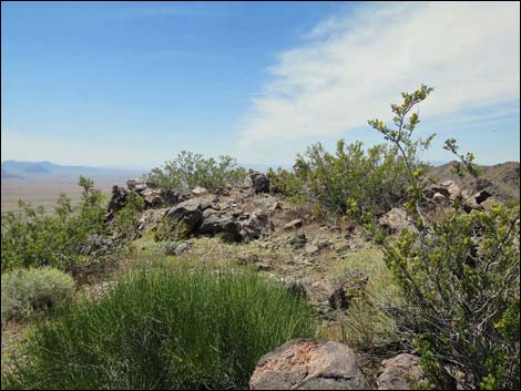 Following the ridge -- the true summit? (view SW) |
 Summit (view NW) |
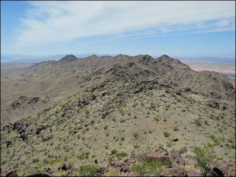 Black Ridge (view SW from summit) |
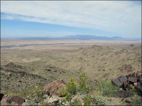 Mormon Mountains (view N from summit) |
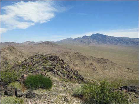 Virgin Peak (view NE from summit) |
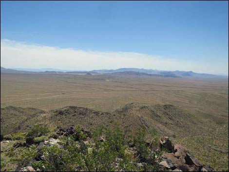 Gold Butte highlands (view S from summit) |
 Descending off the rocky summit, cliffs are hidden (view SW) |
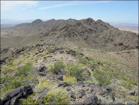 Following the ridge (view SW) |
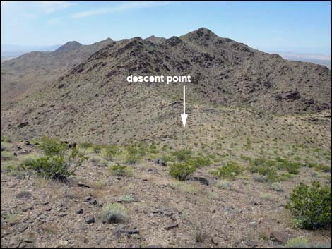 Following the ridge into the saddle (view SW) |
 Ridgeline (view S into gullies and washes) |
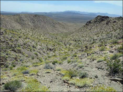 Descending towards washes below (view S) |
 Descending towards washes below (view S) |
 Route on easier desert flats (view S; note game trail across wash) |
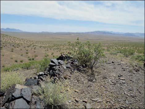 Exiting canyons, route descends across rolling flats (view SE) |
 Lots of spring wildflowers on gentle desert flats (view E) |
Table 1. Hiking Coordinates and Distances based on GPS Data (NAD27; UTM Zone 11S). Download Hiking GPS waypoints (gpx) file.
| Wpt. | Location | UTM Easting | UTM Northing | Elevation (ft) | Point-to-Point Distance (mi) | Cumulative Distance (mi) |
|---|---|---|---|---|---|---|
| 01 | Trailhead | 746776.74 | 4049636.20 | 2,083 | 0.00 | 0.00 |
| 02 | Turn Out of Main Wash | 746802.78 | 4050260.72 | 2,041 | 0.42 | 0.42 |
| 03 | Step Out of Wash | 746791.95 | 4050595.32 | 2,071 | 0.22 | 0.64 |
| 04 | Enter Broad Wash | 746396.65 | 4051103.04 | 2,179 | 0.43 | 1.07 |
| 20 | Mine Shaft | 746134.95 | 4051362.51 | 2,434 | . | . |
| 05 | Wash Forks Three Ways | 745988.96 | 4051808.25 | 2,331 | 0.55 | 1.62 |
| 06 | Start Old Road | 746006.29 | 4051846.20 | 2,339 | 0.03 | 1.65 |
| 07 | Exit Old Road | 745812.35 | 4052006.44 | 2,443 | 0.17 | 1.82 |
| 08 | Saddle Atop Black Ridge | 745647.60 | 4052275.51 | 2,726 | 0.24 | 2.06 |
| 09 | Summit Peak 962 | 745326.67 | 4051619.97 | 3,156 | 0.57 | 2.63 |
| 10 | Begin Descent off Ridge | 745044.32 | 4051482.83 | 2,871 | 0.25 | 2.88 |
| 11 | Turn Towards Trailhead | 745130.85 | 4050339.04 | 2,251 | 0.82 | 3.70 |
| 01 | Trailhead | 746776.74 | 4049636.20 | 2,083 | 1.18 | 4.88 |
Happy Hiking! All distances, elevations, and other facts are approximate.
![]() ; Last updated 240325
; Last updated 240325
| Hiking Around Gold Butte | Hiking Around Las Vegas | Glossary | Copyright, Conditions, Disclaimer | Home |