Hiking Around Las Vegas, Red Rock Canyon National Conservation Area
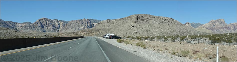
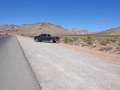
 White Cross Trailhead parking along Highway 160 (view W) |
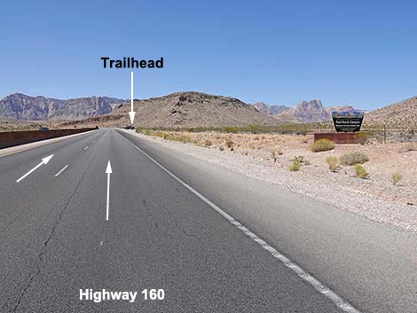
White Cross Trailhead, an unofficial pullout along Highway 160 about 175 yards west of the Red Rock Canyon NCA boundary sign, provides access to some of the mountain bike trails south of Blue Diamond Town. White Cross Trailhead is located in Red Rock Canyon National Conservation Area, about 30 minutes west of Las Vegas, but not in the Scenic Loop Road fee area. The trailhead is located on Highway 160, about 1.8 miles west of the intersection with Highway 159 (West Charleston Blvd). Parking here is free. When exiting the highway, keep in mind that the speed limit is 65 mph, so expect other drivers to be driving at 75 mph or faster. The gap in the highway fence is towards the far end of the long parking area. Also, the highway is divided here, so when exiting this trailhead, drivers will need to continue west to turn around. The first place to u-turn is Late Night Trailhead. Link to trailhead map. |
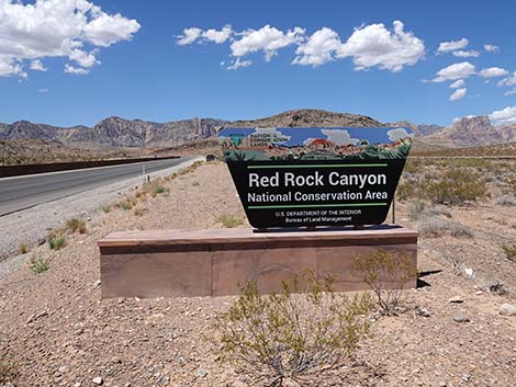 Boundary sign 175 yards before trailhead parking (view W) |
The name "White Cross" comes from a white cross that memorialized a driver who failed to stay on the curving highway. Pay attention and drive carefully here as vehicles often are traveling in excess of 75 mph along this section of highway. The White Cross Trailhead primarily is used by mountain bike riders to access the Cottonwood Valley North bike trail system. The town of Blue Diamond is nearly due north of here, just over the ridge. Trails: Ridgeline Loop Trail, Blue Diamond Town Bike Trails, Cottonwood Valley North Bike Trails. Although not a "trail," this trailhead also provides access to the Old Spanish Trail, which ran right through here, although there is no longer any overt evidence of the Old Spanish Trail at this point. |
 Boundary sign 175 yards before trailhead parking (view W) |
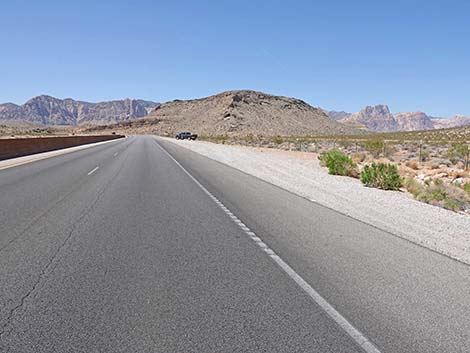
Highway 160 approaching trailhead parking (view W) |
 White Cross Trailhead parking (view W) |
 Hikers and biker duck through gap in the fence (view NW) |
 Gap in the fence (view N) |
 Gap in the fence (view N) |
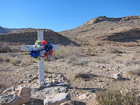 The original White Cross, which was just up the highway (view SW) |
 More to come ... |
Table 1. Highway Coordinates based on GPS Data (NAD27; UTM Zone 11S). Download Highway GPS Waypoints (gpx) file.
| Site | Location | UTM Easting | UTM Northing | Latitude (N) | Longitude (W) | Elevation (ft) |
|---|---|---|---|---|---|---|
| 1182 | Hwy 160 at White Cross Trailhead | 644930 | 3988597 | 36.03293 | 115.39138 | 3,484 |
Happy Hiking! All distances, elevations, and other facts are approximate.
![]() ; Last updated 250603
; Last updated 250603
| Hiking Around Red Rocks | Hiking Around Las Vegas | Glossary | Copyright, Conditions, Disclaimer | Home |