Hiking Around Las Vegas, Red Rock Canyon National Conservation Area
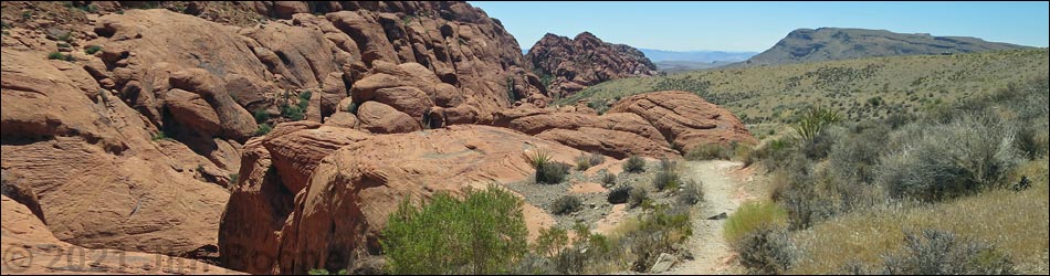
 Sandstone Quarry southbound trailhead (view SE) |
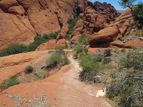
Overview Hiking from Sandstone Quarry to Calico 1 is a nice short hike in a very scenic area, especially with friends who arrive in separate vehicles. Friends can leave one vehicle at Calico 1, drive to Sandstone Quarry in the second vehicle, and walk back to retrieve the first vehicle. The one-way Scenic Loop Road then forces hikers to drive past Sandstone Quarry where they can retrieve the second vehicle. The trail runs south from the Sandstone Quarry Trailhead across fairly level terrain until dropping into Calico Canyon and beginning a long gradual descent, past Calico 2, down to Calico 1. There are some uphill sections, but this trail basically is a long, gradual descent. The sandstone crags above the trail are spectacular, and the cultural history along the trail is interesting. The trail runs through part of the 2005 Loop Fire, and hikers can assess the recovery of desert vegetation over the years. Link to map. Link to BLM Georeference PDF map file. |
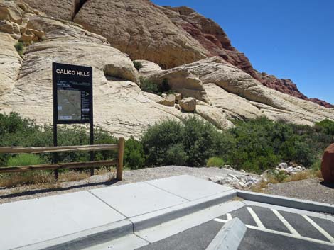
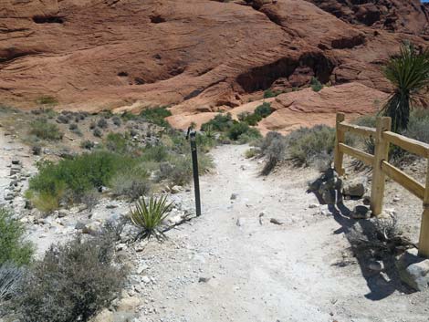
 Sandstone Quarry southbound trailhead sign (view E) |
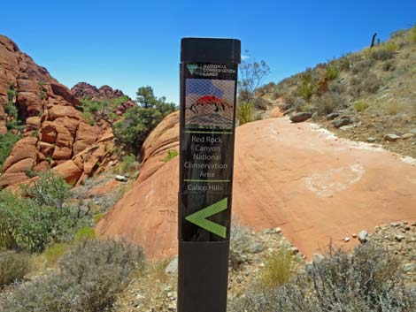
Watch Out Other than the standard warnings about hiking in the desert, ...this is a moderate hike without unusual hazards. However, falls from some places along the trail would result in serious injury or worse. While hiking, please respect the land and the other people out there, and try to Leave No Trace of your passage. Also, even though this is a short hike, be sure to bring what you need of the 10 Essentials. Getting to the Trailhead This hike is located along the Scenic Loop Road in Red Rock Canyon National Conservation Area, about 45 minutes west of Las Vegas. Drive out to Red Rocks, pay the entrance fee, and drive up the Scenic Loop Road for about 3 miles to the Sandstone Quarry Trailhead. Park here; this is the trailhead. |
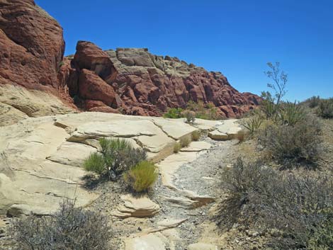
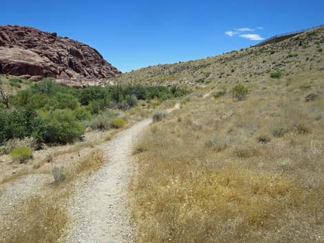
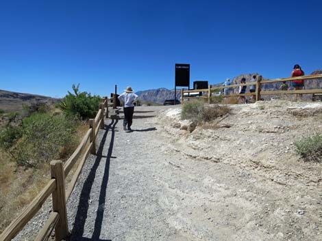
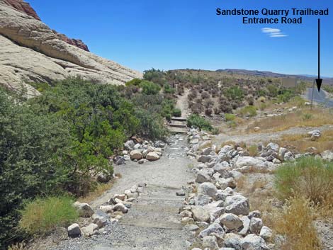 Start of Sandstone Quarry to Calico 1 Trail (view SE) |
The Hike From the trailhead (Table 1, Waypoint 01), the trail runs south, away from the historical Sandstone Quarry area, running parallel to the Sandstone Quarry entrance road. Running at gentle grades, the trail angles away from the road, and at about 150 yards out, crosses a bit of white sandstone slickrock before dropping into Calico Canyon. At about 0.24 miles out, the trail passes red sandstone outcrops on the left edge of the trail and arrives at a trail junction. Here, the main trail stays right on the hillside, while the use-trail to the left drops steeply into the bottom of the canyon. At about 0.61 miles out, the trail passes a trail junction to the right, which trail crews have been trying to block off. The main trail stays left (straight) and descends somewhat steeply over red sandstone slickrock. Shortly after passing off the slickrock, the main trail passes the other end of the blocked-off trail and continues across the hillside. |
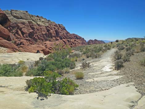
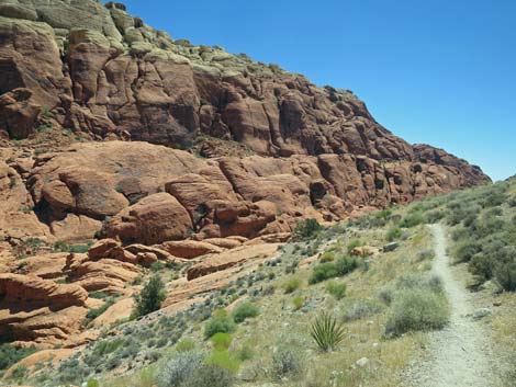
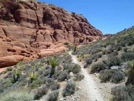
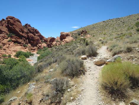
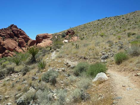
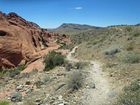
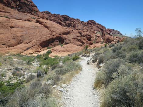
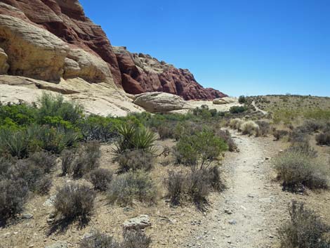 Traversing gentle terrain alongside sandstone crags (view SE) |
Descending gently towards the bottom of the canyon, the trail passes to the right of large boulders (0.77 miles out) that crashed down from the cliffs above. These boulders have drawn the attention of passing people for a long time. Take a minute and see what they left behind. The trail continues along the edge of Calico Wash, then climbs somewhat steeply over a low ridgeline that comes down from the west side of the canyon. Atop this low highpoint (Wpt. 02; 0.96 miles out), hikers get the first good views of the Calico 2 Trailhead area. The trail descends off the highpoint and eventually reaches a trail junction where the Calico 2 Trail branches off to the right (Wpt. 03; 1.09 miles out). For people who need a toilet, the Calico 2 Trailhead is about 150 yards up the hillside to the right. Otherwise, the main trail bends left and descends along the hillside, passing some split-rail fencing intended to keep hikers from clambering straight up the hillside. |
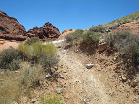
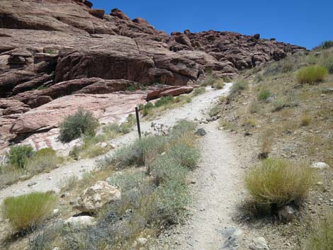
 Approaching white sandstone slickrock (view SE) |
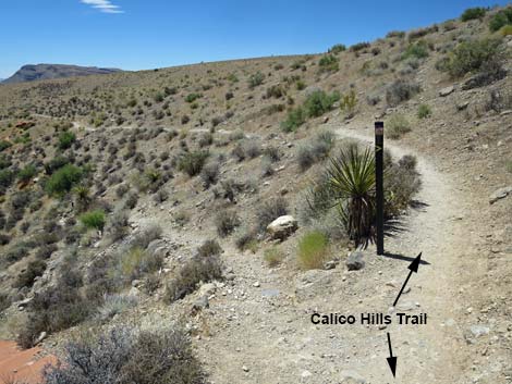
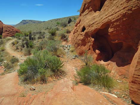
Opposite the fence, a use-trail branches left and heads down into the wash. A few yards farther out the main trail, hikers encounter a second fence on the right and a use-trail on the left that drops into the wash. Shortly, the trail forks (Wpt. 04) where a sign indicates that the Calico Hills Trail stays left. This trail drops into the wash and heads downstream until climbing into the crags to run south parallel to the main trail but closer to the cliffs. This trail, however, stays right at the fork and begins to climb over a low ridge. Atop the low ridge, hikers get big views down Calico Canyon, and Calico 1 Trailhead can be seen atop the ridge on the right in the distance. The trail descends off the low rise at gentle grades to the wash, but stays on the hillside just above the wash. In this area, it is apparent that a wildfire burned the vegetation on the hillside and in the wash. This was the 900 acre, 2005 Loop Fire. |
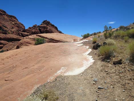
 Crossing white sandstone slickrock (view SE) |
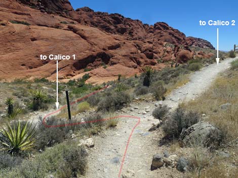
The shrub live oak in the wash has recovered nicely since the fire, but few shrubs survived on the hillside. Lots of dead wood in the oak trees and a few Joshua tree carcasses remind us how some species do well after desert fires and others do not. Continuing along the wash, the trail runs along the wash until beginning to climb onto the next low ridge. At about 1.72 miles out, the trail merges with another trail coming in from the left (Wpt. 05). This is the other end of the Calico Hill Trail that forked off 0.6 miles back. The merged trails now climb at a moderate grade to the crest of the next low ridge where they arrive at a junction with the Calico 1 Trail (Wpt. 06). Turning right onto the Calico 1 Trail, hikers (often with a crowd of tourists) climb straight up the crest of the ridge to Calico 1 Trailhead (Wpt. 07). |
 The trail begins to descend into Calico Canyon |
 Passing red sandstone outcrops alone the edge of the trail (view S) |
 Approaching a trail junction (view SW) |
 Trail junction, stay right (0.24 miles out; view SW) |
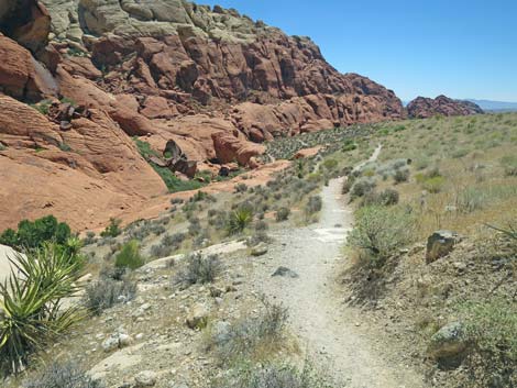
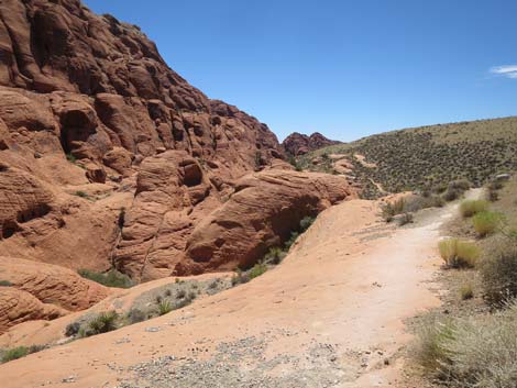
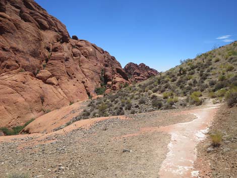
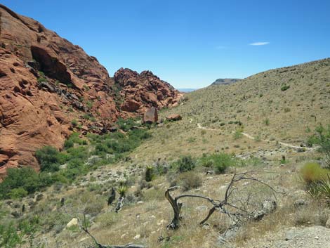
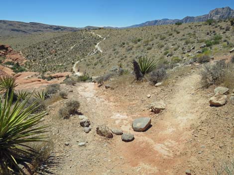
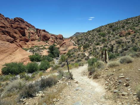
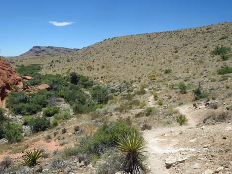
 Long view down Calico Canyon (view SE) |
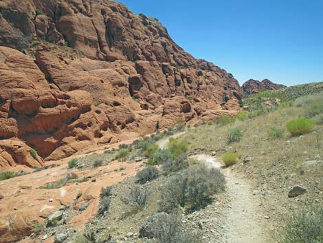
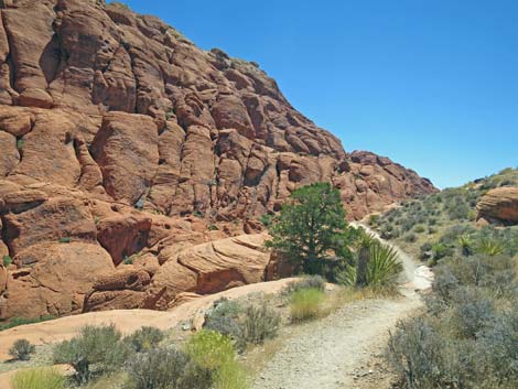
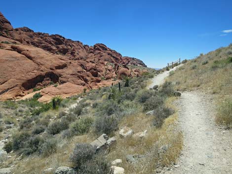
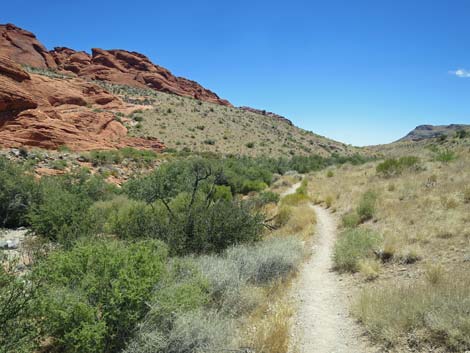
 Trail on hillside below red sandstone cliffs (view SE) |
 Trail on hillside above red slickrock (view SE) |
 Crossing more slickrock |
 Sandstone cliffs towering above (view E) |
 Sandstone cliffs towering above (view NE) |
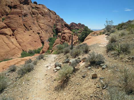
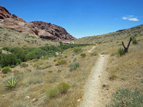
 Long view of the trail ahead (view SE) |
 Traversing hillside with Blackbrush and Mojave Yucca |
 Approaching a Singleleaf Pinyon Pine (view SE) |
 Crossing more red sandstone (view SE) |
 Trail sometimes climbs at moderate grades (view SE) |
 Approaching a low highpoint (view SE) |
 The trail crew discourages people from forking right on use-trail |
 The trail crew encourages people to use the built trail (view SW) |
 Trail descends over red sandstone slickrock (view SE) |
 Trail descends over red sandstone slickrock (view SE) |
 Trail descends over red sandstone slickrock (view SE) |
 The trail resumes the moderate descent across the hillside (view SW) |
 Main trail passes the other end of discouraged use-trail (view SW) |
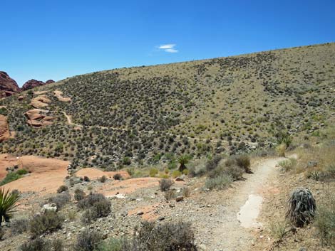
 This area burned in the 2005 Loop Fire (view SE) |
 The trail winds through washed out gullies (view SW) |
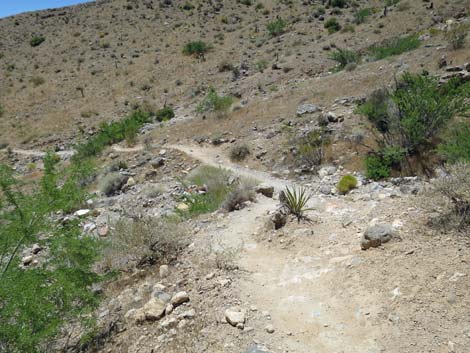
 Trail runs across dirt hillside (view SE) |
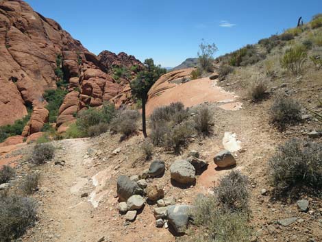
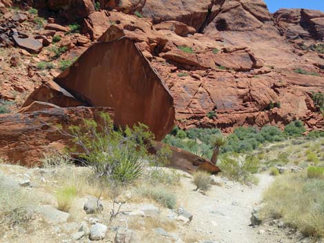
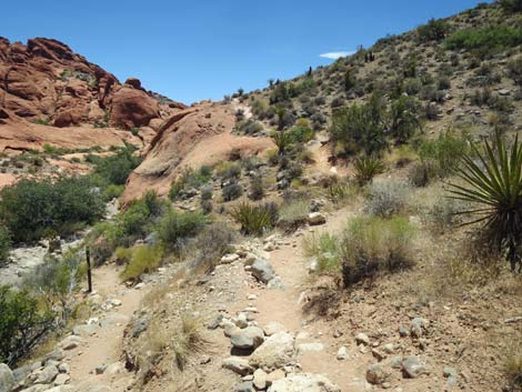
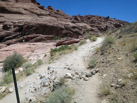
 Detour to cultural site (View SE; 0.77 miles out) |
 Cultural site (view SE) |
 |
 Trail continues around boulders (view E) |
 Cultural site (view NE) |
 Cultural site (view N) |
 Trail continues into the very bottom of the canyon (view SE) |
 Trail approaching a dead pine tree along the wash (view SE) |
 The trail begins to climb away from the wash (view S) |
 The trail climbs more steeply (view S) |
 The trail climbs steeply onto sandstone (view SE) |
 The trail climbs more steeply (view S) |
 Finally, the trail begins to level out (view S) |
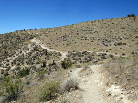
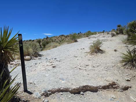
 Approaching the highpoint (view S) |
 Highpoint; Calico 2 comes into view (view S; 0.98 miles out) |
 Not really a fork in the trail; stay right on main trail (view S) |
 Trail crosses a patch of sloping slickrock (view SW) |
 Descending across the hillside (view S) |
 Descending across the hillside (view S) |
 Junction with use-trail that drops into canyon bottom (view S) |
 Major trail junction is visible ahead (view S) |
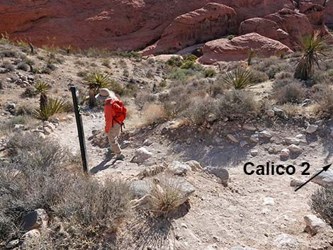
 Approaching Calico 2 trail junction (view SE) |
 Calico 2 trail junction; stay left (1.09 miles out, view SE) |
 Calico 2 trail junction; stay left (1.09 miles out, view SE) |
 The trail continues down across the hillside (view SE) |
 Trail passes fencing (view SE) |
 Approaching another trail junction (view SE) |
 Trail junction; stay right (view SE) |
 Another trail junction; stay right (view SE) |
 Trail junction; staying right (view SE) |
 Sign implies that official trail forks left (view SE) |
 Trail climbs away from the wash (view S) |
 Passing more slickrock (view S) |
 Trail levels out at another highpoint (view S) |
 The trail begins to descend again (view S) |
 Trail descends across the hillside (view S) |
 The trail drops towards the bottom of the canyon (view S) |
 Trail runs along the wash, which is full of shrub live oak trees |
 Trail runs along the wash (view SE) |
 Gentle terrain along Calico Wash (view S) |
 This area burned in the 2005 Loop Fire |
 Gentle terrain along Calico Wash (view SE) |
 Gentle terrain along Calico Wash (view SE) |
 Gentle terrain along Calico Wash (view SE) |
 Last of the gentle terrain along Calico Wash (view SE) |
 Reconnecting with the other end of the "official" Calico Hills Trail |
 Trail junction (1.72 miles out; view SE) |
 The trail climbs rather steeply towards a ridgeline (view SE) |
 Approaching the ridgeline (view SE) |
 Trail junction when crossing the ridgeline (view S) |
 Calico 1 Trail runs up the ridgeline (view W) |
 Hiker stopping to watch a hawk soar by (view W) |
 Hiker climbing towards Calico 1 Trailhead (view W) |
 Hiker arriving back at Calico 1 Trailhead (view W) |
Table 1. Hiking Coordinates Based on GPS Data (NAD27; UTM Zone 11S). Download Hiking GPS waypoints (*.gpx) file.
| Wpt. | Location | UTM Easting | UTM Northing | Elevation (ft) | Point-to-Point Distance (mi) | Cumulative Distance (mi) |
|---|---|---|---|---|---|---|
| 01 | Sandstone Quarry South Trailhead | 639525 | 4002803 | 4,308 | 0.00 | 0.00 |
| 02 | Saddle | 640609 | 4002022 | 4,060 | 0.96 | 0.96 |
| 03 | Calico 2 Trail at Calico Hills Trail | 640620 | 4001854 | 3,979 | 0.13 | 1.09 |
| 04 | Trail Junction | 640678 | 4001845 | 3,968 | 0.04 | 1.13 |
| 05 | Trail Junction | 641280 | 4001206 | 3,868 | 0.59 | 1.72 |
| 06 | Calico 1 Trail | 641328 | 4001168 | 3,895 | 0.04 | 1.76 |
| 07 | Calico 1 Trailhead | 641259 | 4001094 | 3,951 | 0.07 | 1.83 |
Happy Hiking! All distances, elevations, and other facts are approximate.
![]() ; Last updated 240723
; Last updated 240723
| Hiking Around Red Rocks | Hiking Around Las Vegas | Glossary | Copyright, Conditions, Disclaimer | Home |